

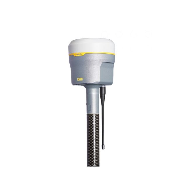
Leica GS18 T GNSS SmartRover
The Leica GS18 T is a cutting-edge GNSS receiver designed for precision and efficiency in surveying. Its robust construction ensures durability on site, while advanced technology delivers accurate positioning in challenging environments. Ideal for construction professionals seeking reliability and performance.
Item ID: 50001010
Reference: 197080
Basic Dimensions
Weight (kg)1.23 (Rover) // 3.56 (standard RTK rover setup on pole)
Height (mm)109
Length (mm)173
Width (mm)173
Convenience Features
Features
- Lightweight
- Robust
- Highest Level of Quality
- Fast
- Reliable
- Data Capture ability
- 555 Channels, Multi-Frequency and Multi-Constellation
Internal MemoryYes
Power Source
Power Source / Fuel TypeBattery
Battery LifeTypical time up to 8 h
Battery TypeLithium
Battery (V/Ah)7.4V / 2.6Ah
Voltage (V)12
Output - PowerBluetooth: 5mW (Class 1)
Safety Information
Protection Class (IP)68
Temperature - Operating (°C)-40 to +65
Temperature - Storage (°C)-40 to +85
Drop Shock & Vibration
- Drop: Withstands topple over from a 2 m survey pole onto hard surfaces
- Shock: 40 g / 15 to 23 msec. Vibration: Withstands strong vibration
Technical Specifications
Accuracy
- RTK – Single Baseline: Hz 8 mm + 1 ppm / V 15 mm + 1 ppm
- RTK – Tilt Compensted: Additional Hz uncertainty typically less than 5 mm + 0.4 mm/° tilt down to 30° tilt
- RTK Bridging: Hz 2.5 cm | V 5 cm
- Post Processing - Static (phase) with long observations: Hz 3 mm + 0.1 ppm / V 3.5 mm + 0.4 ppm
- Post Processing - Static and rapid static (phase): Hz 3 mm + 0.5 ppm / V 5 mm + 0.5 ppm
- DGNSS: Hz 25 cm | V 50 cm
Humidity0.95
Ports
- Lemo: USB and RS232 serial
- Bluetooth: v4.0 (BLE and BR/EDR), class 1.5
- WLAN: 802.11 b/g/n for field control communication only
Purpose/Made for
- Data communication with external appliances.
- Recording measurements.
- Computing with software.
- Carrying out measurement tasks using various GNSS measuring techniques.
- Recording GNSS and point related data.
- Measuring raw data and computing coordinates using carrier phase and
Reliability99.99% (with RAIM and Tilt Compensation)
Technology
- Leica RTKplus: Self-learning GNSS
- HxGN SmartNet Pro
- HxGN SmartNet+
- HxGN SmartNet PPP
Buttons1x On/Off button
Charger TypeMinimum voltage for charging: 14 V DC
Data Links - Built In
- LTE Frequency Bands: 20, 8, 3, 1, 7 | 13, 17, 5, 4, 2 | 19, 3, 1
- UMTS Frequency Bands: 8, 3, 1 | 5, 4, 2 | 6, 19, 1
- GSM Frequency Bands: 900,1800 | 850,900,1800,1900 MHz
- UHF Radio Modem: 403 – 473 MHz, channel spacing 12.5 kHz, 20 kHz, 25 kHz, max. 1 W output power up to 28800 bps over air or 902 – 928 MHz (licence free in North America), max. 1 W output power
DisplayWeb Server: Full status information and configuration options
Maintenance / Calibration (Months)12
Measurements
- GPS | GLONASS: L1, L2, L2C, L5 | L1, L2, L2C, L3
- Galileo | BeiDou: E1, E5a, E5b, AltBOC, E6 | B1I, B1C, B2I, B2a, B3I
- QZSS | NavIC: L1, L2C, L5, L62 | L5
- SBAS | TerraStar: WAAS, EGNOS, MSAS, GAGAN | L-Band, IP
Network RTKHz 8 mm + 0.5 ppm / V 15 mm + 0.5 ppm
No. of Channels555
On-the-fly (OTF) initialisationTypically 4 sec
PPPHz 2.5 cm | V 5 cm
Protocols
- RTK data protocols: Leica, Leica 4G, CMR, CMR+, RTCM 2.2, 2.3, 3.0, 3.1, 3.2 MSM
- NMEA Output: NMEA 0183 V 4.00 and v 4.10 and Leica proprietary
- Network RTK: VRS, FKP, iMAX, MAC (RTCM SC 104)
RecordingLeica GNSS raw data and RINEX data at up to 20 Hz
Satellite SignalsGPS, GLONASS, Galilileo, BeiDou, QZSS, NavIC, SBAS, TerraStar
User / LED8x Status LEDs
Capacity - Data (GB)4


